STEEP AND CROOKED: THE MINING RAILROADS OF THE CANADIAN BORDER
By Bill Laux
CHAPTER TWO
THE CRY FOR A RAILROAD
1889 – 1896
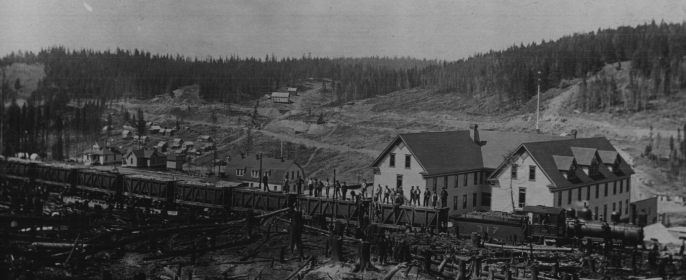
Photo taken from Bill’s Archive
Daniel Corbin had from the beginning intended that his Spokane Falls and Northern Railway should enter Canada and reach the shores of Kootenay Lake where half a dozen mining camps needed transportation for their ores. Before his graders began moving dirt, he went to Victoria, B.C. to petition the legislature to grant him a charter for a railroad from the border point, Waneta, to Nelson, B.C. His line was to run up Beaver Creek to an easy pass over to the Salmo River, and follow that stream to its source. From there it would descend Cottonwood Creek to Kootenay Lake at Five Mile Point. Here, it would reverse direction and run along the shoreline into Nelson.
Corbin knew the continuing desire of the Vancouver an Victoria business communities for a direct route through southern B.C. to the Kootenays which had been fermenting ever since Captain Ainsworth’s persuasive plan of 1884. The building of a “Coast to Kootenay” railway had been vigorously urged on anyone thought to have the resources to undertake such a project.[i] Corbin therefore accompanied his request with a second petition for a charter for that “Coast to Kootenay” railway branching off his SF&N line at Marcus, and running up the Kettle River valley into Canada and the then westward to Vancouver. He was intentionally vague about its route for which he had no survey. His proposal stated only that the two lines he petitioned for, “…would form one continuous line of railway from the south (sic) end of Kootenay Lake to the Coast, with a short detour into American territory, rendered necessary by the difficulties of penetrating the chain of mountains on the west bank of the Columbia River.”[ii]
For the second time, an American was appealing to the nationalistic sentiments of Canadians to secure a charter and land grants for an American railroad. Nelson, largely American in population, was strongly behind Corbin. But the merchants on the Coast remembered how they had been duped by Captain Ainsworth. It all depended on how you looked at the map. One could read it from the north as a line of railway running from Nelson, on Kootenay Lake, dipping into the U.S. at Marcus, where a branch line ran to Spokane, and then back into Canada to run west to Vancouver. Or, if one turned it around and looked at it from the south, it appeared to be two lines feeding Spokane from Nelson and from the B.C. Coast. After an initial burst of enthusiasm for Corbin’s scheme, the coastal merchants turned distinctly cool, realizing that it was another American effort to capture Kooteany trade for themselves.
Corbin needed a Canadian ally to front for him. He turned to Colonel James Baker, member of the provincial legislature for East Kootenay. Colonel Baker had been promoting his own B.C. Southern Railway to run from the rich coal deposits of Crowsnest Pass to the Coast, but had been unable to raise the money to build it. He saw in Corbin the man with the funds to build his line, and proposed trading his political influence in the legislature for Corbin’s financing of his B.C. Southern. Corbin accepted this partnership at first, but when he saw Baker’s bill, which chartered and gave land grants to Baker’s line, but left Corbin in a distinctly subsidiary role, he quickly backed out. Without any influential support in the legislature, Corbin’s two charter proposals were voted down.[iii]
Corbin did not give up. Since both the Dominion and Provincial Governments could issue charters for railroads and grant subsidies, he went to Ottawa to present his charter petitions to the Federal government. But B.C. Premier, John Robson, who feared all American schemes, sent a telegram to the parliamentary Railway Committee, suggesting that his government would support Corbin’s petitions only if Parliament expressly stipulated that both railroads would be built simultaneously.[iv] The City of Vancouver made its opposition known as well, stating that it believed the “Coast to Kootenay” line was just a bait to get a charter for a very profitable Spokane to Nelson connection. Final and definitive opposition came from President Van Horne of the Canadian Pacific Railway. He promised that if Corbin’s proposals were rejected, the CPR would build its own railroad into the Kootenays. This satisfied the overwhelming majority of parliamentarians, many of whom admitted that they had entertained Corbin’s proposals only to force the CPR to commit itself to build into the Kootenays.[v]
Back in Nelson, the residents were outraged at losing a rail connection to the world, and vented their anger by boycotting Canadian goods, and continuing to send their mail out via the U.S.A. In the first year of its operation, one third of the stamps sold by the Canadian Post Office in Nelson were American.
Dan Corbin had learned from his two failures the deep suspicions with which Americans were regarded in Victoria. He therefore allied himself once again with Canadian partners, though this time of more probity than Colonel Baker. A group of Kamloops merchants, John Mara, Frank Barnard and Captain John Irving, had organized the Columbia and Kootenay Steam Navigation Company to build and operate a fleet of sternwheel steamers on the Columbia River and Kootenay Lake.
Captain Ainsworth’s portage railway between the river and the lake was now the CPR subsidiary, Columbia and Kootenay Railway. Using the rail line as a connection, the CKSN steamers began a very profitable service, moving the Kootenay Lake silver lead ores to the C&K at Nelson, and receiving them at Robson on the Columbia for forwarding to the Revelstoke smelter. But the badly mismanaged Revelstoke smelter proved a failure. During a protracted dispute with the government about who was responsible for stabilizing the eroding riverbank under it, the smelter collapsed into the Columbia River. The ore than began to move the other way, from Robson downstream to Dan Corbin’s railway at Little Dalles. Dan Corbin, even without crossing the border with his rails, had by 1891, much of the Kootenay ore and most of its trade.[vi]
Van Horne had not forgotten his promise. He was determined to shut Corbin out and monopolize Kootenay trade for the CPR. He sent his surveyors out to discover whether the much discussed “Coast to Kootenay” railroad was feasible, and what route it could take. They reported that such a line, though difficultmand costly, could be built. The C&K portage railway would form its center segment. A line in from Alberta could join it at Nelson, and from its terminus on the Columbia, a line could be built west to the CPR main line opposite Hope. Meanwhile, Corbin, with his new allies and their Columbia and Kootenay Steam Navigation Company, had his dual charter petitions presented a second time to the B.C. legislature. This time five respected British Columbians asked for the Nelson and Fort Shepherd charter and Corbin petitioned for his Marcus to Vancouver line.[vii] The legislators were so indignantly preoccupied with rejecting the American’s request, that they granted the Nelson charter to the five Canadians without a thought. His ruse had worked; Dan Corbin now had his way cleared into Canada.[viii]
Corbin at once pushed his graders across the line and began building toward Nelson. But Van Horne moved to block him. Corbin’s line, descending the steep grade out of Cottonwood Creek, had to contour around the bluffs above Nelson to maintain its grade and reached the lake five miles east of town. It was then to run back along the lakeshore to enter Nelson from the east. Van Horne persuaded the the B.C. government to grant the CPR exclusive rights to the foreshore of Kootenay Lake east of Nelson as a right of way for his proposed line from Alberta. When Corbin’s graders reached the lake at Five Mile Point, the found the route into Nelson blocked by the CPR Railway Reserve.
Undaunted, Corbin built a line down beach to the water where freight and passengers could be transferred to the obliging CKSN steamers for the last five miles into Nelson. Corbin opened his Nelson and Fort Shepherd in 1893, and that winter the Columbia froze solid from Revelstoke down the Arrow Lakes, severing the CPR connection until May.[ix] Corbin’s trains, however, ran daily to Spokane, all winter long.
That severe winter of ‘93 -’94, and Dan Corbin’s railway, definitively attached the Kootenays to Spokane.
Van Horne gave order to build a branch line south from Revelstoke along the river to Wigwam to bypass the winter ice blockades, but it was not until 1896 that the line was completed. Continuing ice problems south of that point required the line to be extended all the way to Arrowhead in 1898. There were ice problems farther south in the Arrow Lakes as well, and the wooden hulls of the early sternwheelers were being ripped and splintered by combats with ice. It was not until the Minto and Moyie were built in 1898 with steel sheathing along their waterlines, that the CPR had a pair of sternwheelers capable of breaking ice. Ordinarily, after a freezeup of the Lakes, a sternwheeler would push a wooden barge with steel sheathing along the waterline to break the ice. The barge, wider than the steamer, would make a channel through which succeeding trips could be made with a bare steamer. Using a barge on every trip would have made the trip much too slow to keep the schedule.
Meanwhile, Daniel Corbin was clearly winning. Up at Red Mountain, he had selected for his railroad land grant a tract which included everything north of First Avenue in the Rossland townsite.[x] This land was in a kind of legal limbo until Corbin could finish his N&FS line, whereupon the land would be turned over to him. It was alienated railroad grant land, but still without title or ownership. On this squatter’s paradise sprung up a shabby collection of shacks, nondescript saloons, dance halls, 24 hour restaurants, gambling rooms and used goods emporiums between the town of Rossland and the mines. It was called “Sourdough Alley,” and its dubious attractions lined the muddy trail up to the mines. Beyond the reach of the law, it was a place wholly without authority. The miners, coming off shift, had to pass the music of its dance halls, the cries of its barkers, the boozy smells from its bars, and the inviting plank walks leading to the red curtained windows of Popcorn Kate, Scrap Iron Nell, and Broken Hip Georgia. Few men got home on payday without being waylaid by one or another of the Sourdough Alley hucksters or their female colleagues.[xi]
When the grant was turned over to Corbin, he knew he had the key to the Red Mountain mines in his grasp. No railroad, Van Horne’s, or Colonel Baker’s, or the Northern Pacific, could now reach the mines without crossing his grant. [xii]
The Le Roi Mining Company built a toll road in 1892 leading out of the west end of Rossland through the shallow pass leading to Little Sheep Creek. It ran down the creek to the border and on to the Columbia River opposite Northport. Forty extra- heavy, 5 ton ore wagons were placed on this road hauling Le Roi ore to the river and supplies back up to Rossland. A small reaction ferry took the wagons across the river to Dan Corbin’s railroad. A reaction ferry was a barge tethered to an overhead cable running from towers on both banks. By angling the barge to the current with a hand winch, the force of the current would push the barge across the river. For the return trip the angle to the current would be reversed.
This road connection to Northport and Corbin’s railroad, bypassing Trail altogether, alarmed Colonel Topping and the Trail merchants. They vigorously lobbied the B.C. legislature for funds to build a Trail – Rossland wagon road up Trail Creek gulch. Funds were appropriated; the road was graded, and a connecting road was built on the east side of the Columbia, south to the N&FS rails at Sayward.
Haulage on the American route down Little Sheep Creek to Northport cost $4.00 per ton. On the Canadian route the cost was $4.25. With wagon haulage at $4.00, mining costs averaging $12.00 per ton, and rail freight plus smelter charges amounting to another $10.00 per ton, $26.00 ore could now be moved from those stockpiles at the mine to the Montana smelters. Still, $26.00 ore only accounted for a fraction of the material in the veins under Red Mountain. A railroad to the mines, hauling ore for something like $1.00 a ton, was required if the mines were to have more than a short life.
Railroad men were interested, but the great depression of 1893 – 1898 had set in and capital was hard to find. Moving B.C. ore to Montana was not the sole attraction. Every ton of ore required roughly a half a ton of coal to mine and smelt it. At Red Mountain the mine hoists, the pumps, the air compressors, the lighting generators were all worked by steam. At that time the all those steam boilers were fired with wood from the surrounding forests (on Corbin’s grant). As the mines went deeper, the machinery got bigger, and the mountainsides around Rossland were stripped of their timber. The woodcutters were having to move farther out and the cost of their wagon haulage increased. Coal for the Rossland mines became a topic of speculation in southeastern B.C. Paper railroads were drawn up from the coal mines of the Nicola Valley, near Merritt, to Rossland. The Canadian Pacific had a profitable business hauling coal from mines on Vancouver Island, and wanted no competition. It saw to it that the paper railroads remained just that. Dan Corbin was bringing coal into Nelson and Northport from the Roslyn mines on the Northern Pacific. The empty Le Roi ore wagons brought some of it up the steep toll road to Rossland at considerable expense. There was also a problem at the border. Canadian law required that only Canadian horses could haul freight in Canada. This meant a change of horses at Patterson, as the American horses could haul empty wagons in Canada, but not loaded ones.
Steamers were still the chief means of transport. Rossland travelers to Spokane took the stage down the steep wagon road to Trail and boarded one of CKSN Company’s sternwheelers. The new steamer, Columbia, was built in Northport in 1891 expressly for this service with dimensions, 152’ x 28’, and 534 gross tons.[xiii] Under the command of Captain Gore, she left Revelstoke on Mondays and Thursdays at 5:00 AM with passengers and freight off the CPR main line for points south. She arrived at Robson at 6:00 PM the same day where passengers could take the C&K train to Nelson. It was impractical to attempt to make the tricky run down the shallow and twisting Columbia to Trail at night, so she tied up at Robson until morning. A steamer pilot had to be able to see down into the water ahead to identify sandbars, snags and rocks. No acetylene searchlight could give the Captain a view of the bottom of the river ahead.
On Tuesdays and Fridays, at 5:00 AM, Captain Gore would pilot the Columbia down the riffles of the river for an 8:00 AM arrival at Trail. Picking up passengers for Spokane, the Columbia would proceed down river and arrive at Northport at 10:00 AM. This schedule could only be maintained in the good water months. In winter and early spring, low water limited the tonnage a boat could carry downstream from Robson. In extreme low water, runs below Robson were canceled.
When delivery of urgent freight required runs to be made through rapids or over gravel bars, two methods were used to get the vessel through. At Rock Island Rapids, below Trail, at Cottonwood Narrows, opposite Burton, and at Death Rapids, above Revelstoke, iron ring bolts were set in the rock bluffs along the riverbank. The crew would drag out a steel cable, wading through the shallows, and hook the end in the ring bolt. Then, using the steam powered capstan on the foredeck, the Captain would winch his boat up through the rapids or over the gravel bar. This “lining through” was used nearly every winter at Burton until the 1950s.
When a vessel had to cross a sand or gravel bar, and no ring bolt was available, the steamer could be “grasshoppered” through, an heroic method which drastically shortened the life of the vessel. In “grasshoppering,” 8” x 8” timbers were pivoted vertically to the sides of the vessel and let down so that their submerged ends were slightly below the level of the boat’s keel. They were then set pointing forward at a slight angle, and the boat run at the bar at full speed. The lower ends of the timbers would jam into the bar and the inertia of the boat would cause them to pivot, raising the steamer as they passed dead center. This violent “jumping” of the vessel on its “grasshopper legs,” alarmed some passengers and delighted others. Few of the lightly built river steamers could survive many episodes of “grasshoppering.” But in the practice of the day, a river sternwheeler was expected to pay its construction cost in three trips. When, such violent use rendered the hull “hogged” (loose and humpbacked) the boiler and engines would be removed, placed in a new hull, and the old one converted to a scow.[xiv]
The Columbia burned in 1894, and was replaced on the Robson – Trail – Northport run by the smaller Lytton. The service from Revelstoke down the Arrow Lakes to Robson was handled by the palatial and much larger, Nakusp, at 1080 tons. The big Nakusp drew too much water to navigate the shallows downstream from Robson, so freight and passengers were transferred to the Lytton for the run through Tincup Rapids to Trail, and Rock Island Rapids to Northport. As more and more of the Red Mountain mines came into production, the Trail – Northport business boomed. The Lytton was making the run daily by 1895, leaving Robson at 5:00 AM and arriving at Trail at 8:00 AM. The border point, Waneta, was reached at 9:00 AM, and arrival at Northport was at 10:00 AM. At 1:00 PM she left Northport for the difficult upriver run, not reaching Waneta until 3:00 PM, and finally, Trail at 4:30. In that three and a half hours of churning at full speed, the Lytton had climbed 70 vertical feet in twenty miles, about the same as ascending the Panama Canal without the locks. It was a considerable feat, performed daily. In winter she was often obliged to “line through” Rock Island Rapids, which took an extra hour.[xv]
Disaster overtook the North American West in 1893. The nearly unlimited coinage of silver in the U.S. had created a run on gold, as the newly rich Nevada and Colorado silver millionaires rushed to convert their silver to gold.[xvi] Banks, short of gold, failed, and a general financial panic turned into the most profound and lasting depression the American continent had known. With the repeal of the Sherman Silver Purchase Act, the U.S. Treasury suspended silver purchases, and the price of the metal began to drop. Then, the Government of India, the next largest world buyer of silver, suspended coinage of the silver rupee. Silver dropped to $.62 and ounce and silver mines all over the west closed. Only gold, in short supply, was booming. And Rossland,with its gold mines, was filing up with American miners, turned out of the Idaho, Nevada and Colorado mines.
In Spokane, young Jay P. Graves, who had come from Illinois with his brother, Frank, had invested heavily in city real estate. With the depression of 1893, he found his properties’ values rapidly deflating. With his Spokane business at a standstill, he accepted an offer from a group of Montreal speculators, including former Prime Minister, Sir Charles Tupper, and ex-parliamentarian, Charles Pope. Pope’s Big Three Mining Company, with claims and mines in British Columbia, was headquartered in Spokane, the only location that made sense in those years when ice closed down winter transportation in the Kootenays.
Jay Graves was known to Pope, and although Graves considered mining an objectionably risky venture, his brother, Frank, was making a good thing out of his investment in the Le Roi. Pope asked Jay Graves to take over the management of the Big Three’s B.C. mines. With nothing else doing, Jay Graves accepted, and hired the knowledgeable Yolen Williams from one of the closed Coeur D’Alene mines, as his superintendent. Graves moved his family to Rossland where he took over the California Mine, just 600 feet west of the Le Roi. The Le Roi was turning out $84,000 of gold – copper ore every twenty four hours, and the nearby California, on the same veins, was expected to prove equally rich.[xvii]
As Jay Graves sat in his frame office at the California mine watching the lumbering ore wagons of the Le Roi Company passing below on their way toward Northport, he was sometimes visited by prospectors from the mountain farther west. Believing he represented some of the richest men in Canada, a fiction Graves blandly sponsored, they showed him ore samples from the Boundary Range of the Monashee Mountains. Copper and gold. Would Mr. Graves interest some of his Eastern principals in buying their claims? they asked. Graves looked at he specimens. His older brother, Frank, had bought into the Le Roi after a similar inspection of Colonel Topping’s specimens. And now the Le Roi was supposed to be the richest gold mine in the world. Jay Graves looked at the specimens and hesitated. The Monashee country was wholly unknown. No roads at all, just that notorious Dewdney Trail. If there should be rich ore there, how could it be gotten out?
Graves thanked the prospectors and put their samples on his shelves. The Second of the Great Boundary Bonanzas had been located, although no one yet knew its value.
Over on the other side of the Le Roi mine, at the War Eagle, the Clark bothers, Patsy and James, also from Spokane, were in charge. They had joined the syndicate which had bought the War Eagle from Moris and Bourgeois, and had found the main vein which previous leasers had missed. The War Eagle had become a bonanza producer in 1895, and now they were visited by prospectors as well. These were American prospectors, displaying their ore samples after swearing the Clarks to secrecy. For the specimens had come from the Colville Indian Reservation where prospecting was forbidden and entry was barred to whites. But, the men hinted, one might venture onto those lands with the perfectly legal intent to trade horses with the Indians, and on the way, might pick up an interesting rock to show the Clark brothers. In fact, the men confided in hoarse whispers, a clandestine mine had already been opened on Toroda Creek. It was the Bodie, and its gold was being smuggled out to the Okanogan River steamer ports.[xviii] If the Clarks, as important Spokane investors, could bring influence through their congressman, to have that part of the Colville Reservation opened to white entry, they suggested, there was a great mineral potential there.
The Clarks made a note to speak to their U.S. Senator, Wilson. The third Boundary Bonanza had been noted, though for the time being it remained a close secret among a few adventurous prospectors.
Dan Corbin was the first to answer the cry for a Red Mountain railroad by sending his engineer, E. J. Roberts to locate a route in 1894. Canadians will recall Roberts as a former Canadian Pacific surveyor who is shown in the famous Last Spike photograph at Craigellachie, the young man on the right in the slouch hat.
Roberts staked out a line, starting just across the Columbia from Northport, and running up Big Sheep Creek and then its tributary, Little Sheep Creek, into Canada and climbing the pass into Rossland at the White Bear mine. But a serious obstacle had be overcome before grading could begin. The whole line, from the Columbia River to the Canadian border, lay within that same forbidden Colville Indian Reservation. Permission to cross it would have to be obtained from a distant and obdurate Congress.
Down at Trail, the residents worried. Dan Corbin’s application to cross the Reservation lands was before the American Congress. If it were approved, Corbin would build his line, and Rossland ores and passengers would go out to Northport and the U.S.A. Rossland then, and not Trail, would become the commercial center of the Kootenays, and Trail would wither to a dusty steamer landing of no importance. Colonel Topping’s townsite was in jeopardy. Its fate was in the hands of a distant Congress, its residents powerless to affect the decision. They wondered if it were not time to sell out and move to Northport.
There were some efforts to save Trail. Peter Larsen was an American railway contractor from Butte Montana. He had built part of Corbin’s Nelson and Fort Shepherd line in 1893 and become interested in the Red Mountain mines across the Columbia. One of his next jobs was standard gauging the Canada and Great Falls Railway from Lethbridge, Alberta to Great Falls, Montana. The completion of that job left him with a great tonnage of light narrow gauge rails. Just right for a line to bring that Red Mountain ore down to the Columbia. Larsen announced on June 1, 1895, that he had otained a Federal charter for his Trail Creek and Columbia Railway Co. This would be a light tramway from Trail up to the Red Mountain mines. He brought a barge load of those used 28 pound rails from the Alberta Railway and Coal Company whose lines he was standard gauging out of Lethbridge. The rails were barged down the Columbia from Revelstoke and dumped on the beach. Someone proposed to supply a horse to pull tram cars up to the mines on these rails if they should be laid.[xix]
However, nothing was done; no one would invest in Larsen’s scheme. Dan Corbin was building a real railroad, standard gauge, to the mines whenever he should get permission from Congress. It was doubted that a competing tramway could be profitable. Then A.E. Humphries and Martin King proposed an aerial cable way to bring ore down from their Iron Horse mine above Rossland. Like Larsen’s project, no one came forward to invest.
The situation in Trail appeared grim. At any day, Corbin’s permission might arrive from Congress. Trail would be dead. Rossland and Northport would triumph. Then, precisely at that anguished moment, three young and close-mouthed Americans strode down the gangplank of the Lytton to inspect the Red Mountain mines. They were James Breen, mining engineer, J.D. Farrell, a railroad man, and that same A.E. Humphries of the abortive cable way scheme. Humphries modestly gave his vocation as “Promoter.” The three examined the Red Mountain mines with great thoroughness. Engineer Farrell produced and instrument and began checking possible grades and distances up to the mines. Promoter Humphries engaged Colonel Topping in confidential conversation regarding his real estate. Would the Colonel consider offering them an interest in his townsite, say two thirds? in exchange for the erection of a smelter which would be the making of his town?
The Colonel was ecstatic. Salvation for his town at the last moment ! It was just like Moris and Bourgeois walking into Hume and Lemon’s store in Nelson to make over the Le Roi claim to him five years before! Henceforth, the Colonel would never distrust his luck.
Topping offered 40 acres on the level bench north of town, and one third of the townsite company. Breen, meanwhile, concluded a contract with the Le Roi Mining Company for 37,500 tons of ore and a promise of 37,500 tons more when the smelter should be up and the railroad running. As the signatures dried on the documents,
the three men, all in their twenties, revealed themselves to be agents for Frederick Augustus Heinze of New York and Butte, Montana, an American mining and smelting millionaire, just 26 years of age.

It so interesting to read about the history and development of railroad in Canada.
LikeLiked by 1 person
I am so glad you like it. Thank you!
LikeLiked by 1 person
You are welcome Peter 🙂
Awaiting for that picture that you mentioned last week!
LikeLiked by 1 person
very interesting story, Peter. How’s winter in Canada right now? Here it’s cold and icy, kind regards Mitza
LikeLiked by 1 person
We are just getting out of the deep freeze. For the first time in weeks the temperature is above freezing. Rain mixed in with snow! I like the cold sunny weather much better. Kind regards, Peter.
LikeLiked by 1 person
Hier ist herrliches Winterwetter, Sonnenschein, viel Schnee und -8 bis -15 Grad C!! Viele Gruesse
LikeLiked by 1 person
Nach einer langen Kältewelle ist Tauwetter und bedeckter Himmel. Mit Sonnenschein ziehe ich die Kälte vor. Herzliche Grüße, lieber Norbert und Christa!
LikeLike